Technology and Innovation

HHI's research on Technology and Innovation examines the impact of emerging technologies on the humanitarian field, focusing on both ethical and technical considerations. Explore the individual programs below to learn more about this work. 

Back to Research

Technology and Innovation

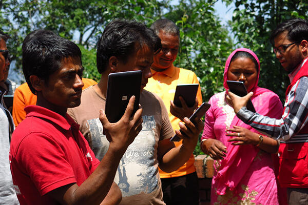
KoBoToolbox

A suite of tools for field data collection for use in challenging environments

Signal Program

Advances the safe, ethical, and effective use of information technologies by communities of practice during humanitarian and human rights emergencies

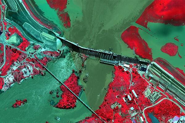
Humanitarian Geoanalytics

Leverages the potential of geospatial data and analytics to introduce new ways of thinking, identify targets for micro-planning and research, and optimize resource allocation for cost-effective programming

DataPop Logo

DataPop

Works to ensure that Big Data serves the interests of people across the globe, especially those of poor and vulnerable populations. Links to an external site.

Related Publications

Ziad Al Achkar, Isaac L. Baker, and Nathaniel A. Raymond. 3/2016. Imagery Interpretation Guide: Assessing Wind Disaster Damage to Structures.Abstract

At present, accepted methodologies for wind disaster damage assessments rely almost exclusively on responders having ground access to the affected area to document damage to housing structures.  This approach can prove both time consuming and inefficient, and does not support the use of drones and satellites.

Geospatially-based damage assessments offer potential improvements to this process in terms of providing responding agencies with previously unavailable information about hard to reach, often non-permissive environments, at a scale and speed not possible through ground-based counts of damaged structures.

This guide provides the first standard method for conducting these types of damage assessments through the analysis of drone and satellite imagery. The “BAR Methodology” has been developed by the Signal Program on Human Security and Technology at HHI to address this critical gap in this evolving area humanitarian practice.

Nathaniel Raymond, Ziad Al Achkar, Stefaan Verhulst, and Jos Berens. 5/2016. OCHA Think Brief: Building Data Responsibility into Humanitarian Action.Abstract

Building data responsibility into humanitarian action is the first UN Office for Coordination of Humanitarian Affairs think brief to explore what constitutes the responsible use of data in humanitarian response. It was co written by the Signal Program, NYU Gov Lab and the Center for Innovation at Leiden University.

This paper identifies the critical issues humanitarians face as they strive to responsibly use data in operations. It also proposes an initial framework for data responsibility.

Ziad Al Achkar and Nathaniel Raymond. 11/2016. Data preparedness: connecting data, decision making and humanitarian response .Abstract

Signal Program Standards and Ethics Series - Issue 1

Data are a central component of humanitarian response. Frequently, however, there is a disconnect between data, decision-making and response. Informed decisions need to be made in the first hours and days of an emergency, and if the elements to effectively gather, manage and analyse data are not in place before a crisis, then the evidence needed to inform response will not be available quickly enough to matter. What's more, a lack of readiness to use data can even cause "big data disasters".

Organizations need to be prepared to responsibly and effectively deploy and manage data collection and analysis tools, techniques, skilled staff and strategies in a specific operational context to be ready before a disaster strikes. This process is called “data preparedness”. The concept of data preparedness complements and expands on existing OCHA principles on the use of information management in disaster scenarios. This paper, which was reviewed by OCHA and other UN organizations, seeks to provide a blueprint for how the concept of data preparedness may be put into practice by members of the humanitarian data ecosystem. It is the first issue in the Signal Program's ongoing "Standards and Ethics" white paper series.
Brittany Card, Ziad Al Achkar, Isaac L. Baker, and Nathaniel A. Raymond. 9/2015. Satellite Imagery Interpretation Guide: Intentional Burning of Tukuls.Abstract

During armed conflict in East and Central Africa civilian dwellings are intentionally targeted and razed. These traditional civilian dwellings are known as tukuls which are primarily mud and thatch huts.

The intentional destruction of these dwellings, given their prevalence in these regions, is often one of the only available indicators of the intentional targeting of civilians observable in satellite imagery.

This field has lacked accepted methodologies for performing this type of analysis. This guide is the first to focus on tukuls because they are a uniquely valuable metric for both documenting attacks on civilians during armed conflicts and assessing potential mass displacement that can result from these incidents.  

This guide is the second in a series of Satellite Imagery Interpretation Guides. Future satellite imagery interpretation guides from the Signal Program may focus on other, related phenomena and structures present in similar operational contexts.

Brittany Card, Isaac L. Baker, and Nathaniel A. Raymond. 4/2015. Satellite Imagery Interpretation Guide: Displaced Population Camps.Abstract

Satellite Imagery Interpretation Guide: Displaced Population Camps is intended to help address the absence of public and standardized training resources for those seeking to use high resolution satellite imagery in support of refugee/IDP assistance operations. Students, general audiences, and volunteers studying and analyzing satellite imagery of displaced population camps may find this training resource beneficial.

The guide provides case studies of displaced population camps in East Africa and the Middle East. Dimensions, colors, shapes, and, when possible, unique identifying features of objects, including civilian shelters and humanitarian agency infrastructure, visible in high resolution imagery of the camps are identified. Objects are organized according to the United Nations Office for the Coordination of Humanitarian Affairs humanitarian cluster system and three other categories unique to this guide. Imagery provided by Google's Skybox Imaging for the creation of this guide can be explored online by following the directions included inside the report.

Brittany Card, Ziad Al Achkar, and Nathaniel A. Raymond. 10/2015. What is 'Humanitarian Communication'? Towards Standard Definitions and Protections for the Humanitarian Use of ICTs. Read PublicationAbstract

In October 2014, the European Interagency Security Forum (EISF) launched a knowledge hub on communications technology and security risk management. The first publication of this project brought together 17 authors who analyzed in 11 articles how communications technology is changing the operational environment, the ways in which communications technology is creating new opportunities for humanitarian agencies to respond to emergencies, and the impact that new programs have on how we manage security.

The most recent contribution to the project comes from the Signal Program on Human Security and Technology at the Harvard Humanitarian Initiative. In their article, al Achkar, Card and Raymond explore what constitutes ‘humanitarian communications space’, and the challenges to agreeing a common definition of ‘humanitarian communication’ and its protection under international law.